 fox swim mapper alternative fox swim mapper alternative
|
7,117 views
|
|
|
|
|
|
|
Looks good (and I edited your post to make the images 500px wide)
|
|
|
|
|
Make the photo smaller by =400> at the end of the link 👍
|
|
|
|
In reply to Post #36
Absolutely no talent involved matey - it’s a google earth photo put through an ai command of make it a drawing I wish I was that good. Regards resize what do you mean?
|
|
| | | Cam | | Posts: 6790 |  | | MODERATOR | |
|
In reply to Post #34
That looks great! Far more talented than me that's for sure. I'm lucky to just draw an outline😀
Any chance you can resize the pic?
|
|
|
|
In reply to Post #34
That's awesome mate 👍
|
|
|
|
I have been having a play with mapping recently and as I tear the arse out of everything thought I would share as maybe 1% of you are as pathetic as me. I’d love to share the final maps however whilst only drawings they are no publicity venues or respectful of others.
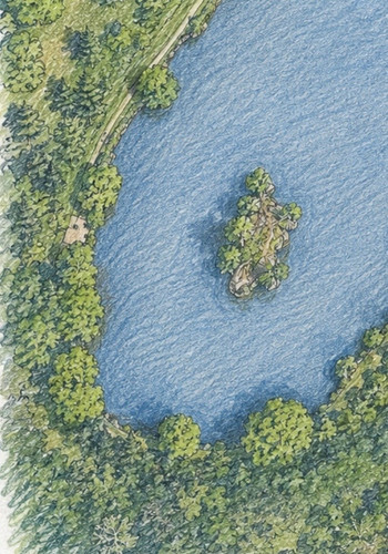
So what I do is take a photo from google earth
Ask chatgbt to make it into a drawing
Get a distance ratio from map to gauge distances
Put on a compass
Use a ‘blind’ name for the map
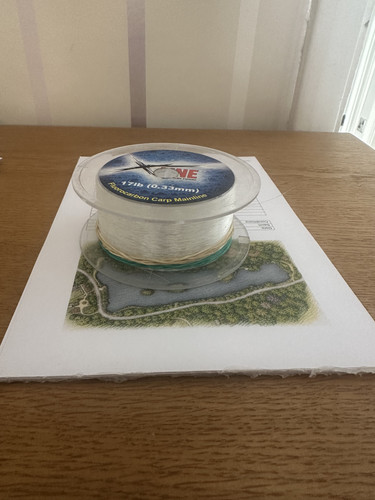
Create a note pad type form that has a bit of standard info date, weather, etc and then lines for notes etc.
I then pad them up up by using a backing board and glue gun of about 25 sheets
|
|
|
|
In reply to Post #1
I don’t use it personally but someone told me about ‘Onfish Angler’
|
|
|
|
Take a look at Piscaro. It's iPhone only at the moment
My brother developed it this year and it contains the functionality to drop swim markers onto photos you take/store on your phone.
LINKY POO™ https://piscaro.app/
It's quite rich in features so it might be slightly daunting when you first look at it...but we even put in things like public venues which it will detect using GPS, so if you rock up at Linear and start a session it will add the prebuilt venue info into your session.
If you want me or my brother to knock up some example usage videos we can do that.
Oh yeah, and it's free to start with (like Swim Mapper was) then there's an option to pay to get extra features etc
|
|
|
|
In reply to Post #30
Same disappointed it's gone
|
|
|
|
In reply to Post #15
Just upgraded my phone and now it's saying swim mapper isn't available, got to note down all of my spots on paper before sending my old phone back to Apple.
Nightmare, I really like that App.
|
|
|
|
In reply to Post #27
Surely though nobody uses Google Earth or Deeper Maps to measure distances for fishing? The only way to get your measurements is actually at the lake isn't it?
People actually used to 
This was where my argument of modern technology is not always better than old fashioned methods springs to mind.
YES, modern technology can be an improvement or make life easier, but there are times...
|
|
|
|
In reply to Post #27
>>>>Surely though nobody uses Google Earth or Deeper Maps to measure distances for fishing? <<<<
It's useful as a guide to get you into the right "Ball Park" before you start fishing so taken as a pinch of salt as sometimes it can be very accurate or inaccurate.
|
|
|
|
I use a deeper for feature finding so really don't mind a bit of Tech to help me out within reason...
Surely though nobody uses Google Earth or Deeper Maps to measure distances for fishing? The only way to get your measurements is actually at the lake isn't it?
|
|
|
|
In reply to Post #25
I noticed the error in Google Earth a while back, I fish a swim with a bush about 34 yards away, when I'm clipped up to cast, I can drop my lead right on the edge of it constantly. The measurement on Google Earth has the distance about 47 yards, if I was to clip up at that, I would be over the bush, across the road behind it and into the pond at the other side of the road.
But, oddly enough, it has the bars which are visible in Google Earth, spot on and it does make me wonder if the error comes from how the satellite view is portrayed and a difference between East to West measurements and North to South measurements which is what I see in my case.
|
|
|
|
In reply to Post #24
Just after Google Maps came out and started being used for fishing I picked up on distances not being totally accurate.
Someone made a comment about the distances from some of the Central Point swims to the golf course bank and was quite upset when I told them how far out their distances were. I think that they were quoting 120 to 130metres. I had actually been up and down the whole bank with a laser range finder/measure so knew the longest cast was only 108m.
Now I don't know if this was down to the joining of the satellite images, or the actual images not considering earth curvature.
I had some lovely pictures on CD of a drained Brackens Pool. The bars in there are unreal, a depth of 22feet, a bar with a vertical side, or undercuts, coming to a depth of 6feet.
|
|

